
Page 4 - anf_calan2464_2009.html
P. 4
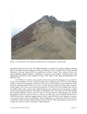
Figure 3. CA-LAN-2464, site condition at initial post-fire reconnaissance, looking north.


               Agua Dulce-Acton area to the east. The southern boundary is framed by the northern foothills of the San
               Gabriel and Santa Susanna mountains, and the north appears to have extended beyond Liebre-Sawmill
               Mountains to the San Andreas Rift Zone and Rancho La Liebre vicinity. These rough territories have
               been established primarily through a combination  of mission records analysis, Spanish accounts, and
               ethnographic interviews  of their neighbors (Caruso 1988; Hudson 1982; King and Blackburn  1978;
               McIntyre 1979).
                       LAN-2464 sits in a relative terra incognita, between the greater Piru drainage to the west and the
               Castaic Creek drainage to the east. Tataviam village sites and placenames in  the Piru Creek drainage
               include pi’irukuung (La Esperanza, under Piru Lake), akavavea (El Temascal), etseng (along Piru, above
               akavavea), huyung/juyubit (on Piru Creek, above etseng), and kivung,(along Piru Creek, above huyung).
               Along Castaic Creek, known sites include pi’ing (junction of Castaic Creek and Elizabeth Lake Canyon,
               now under Castaic Lake), naqava’atang (upstream from pi’ing), and tikatsing and apatsitsing, on upper
               Castaic Creek (Johnson and Earle 1990; King and Blackburn 1978). King (2004:127-128) has used the
               San Fernando Mission records to further tie some of the placenames to  archaeological sites, placing
               pinga/piibit at LAN-324, under the Elderberry Forebay of Castaic Lake. He also indicates that the sites at
               Oak Flat (LAN-248), and below Knapp Ranch (LAN-433, and LAN-434) are the remains of moomga,
               cacuycuyjabit, ajuavit, and/or juyubit/huyung. These identifications are based upon the known names of
               settlements recruited into San Fernando Mission between 1802 and 1805, and postulated as names of sites
               in upper Piru, Castaic, and San Francisquito Creeks (Figure 4).


               SCA Proceedings, Volume 22 (2009)                                                     Vance, p. 4