|
|

Tapia Ranch Development.
Notice of Preparation & Initial Study.
Vesting Tentative Tract Map No. 53822 | Conditional Use Permit No. 02-196 for Hillside Management, Significant Ridgeline Exemption, and Density Controlled Development,
Oak Tree Permit No. 02-196
County of Los Angeles Department of Regional Planning | 320 W. Temple Street, Los Angeles, CA 90012
APPLICANT: Castaic Partners, LLC | 800 Silverado Street Suite 301, La Jolla, CA 92037.
August 29, 2007.
|
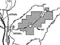
Abstract. The proposed Tapia Ranch project site encompasses approximately 1,167 acres of undeveloped hillside and canyon land approximately 1.5 miles southeast of the community of Castaic, and approximately one mile east of Interstate 5 (1-5) in unincorporated Los Angeles County. The project site is approximately one mile north of the Los Angeles County Sheriff's Department Peter J. Pitchess Detention Center. Offsite areas that would be improved in conjunction with the proposed project are located to the west of the project site and include portions of Castaic Road, Tapia Canyon Road, and the construction of a new bridge spanning Castaic Creek, as well as a small area for the roadway connection to the adjacent Tesoro del Valle project located to the east. The Angeles National Forest is approximately 1.5 miles to the north. The project proposes to develop 405 detached single-family residential homes within the 1,167-acre site, which would result in a gross project density of 0.35 dwelling units per acre. Approximately 308.5 acres would be disturbed by grading and development of these homes and infrastructure. Of this acreage, approximately 195.4 acres would ultimately be covered by structures or other impervious cover. The remaining 113.1 acres within the grading footprint would be revegetated manufactured slopes and other landscaped areas. Therefore, a total of approximately 74 percent (858.5 acres) of the project site would be retained as landscaped or natural open space. The total open space after re-landscaping the disturbed areas would be 971.6 acres or 83 percent of the project area. Development of the proposed project is governed by the Santa Clarita Valley Area Plan, which is a component of the Los Angeles County General Plan. The current General Plan land use designation for the site is "Non-Urban" on the Land Use Policy Map of the Countywide Land Use Element, where slopes typically exceed 25 percent. The site is designated as "Hillside Management" under the Santa Clarita Valley flea Plan. A slope density analysis was completed, and VTTM 53822 has been designed to conform to the Santa Clarita Valley Area Plan's maximum density threshold for hillside management areas, which would allow for the development of up to 405 dwelling units.
Download pdf here.
|
NOP, Initial Study 2007
Water Supply 2018
|
The site owner makes no assertions as to ownership of any original copyrights to digitized images. However, these images are intended for Personal or Research use only. Any other kind of use, including but not limited to commercial or scholarly publication in any medium or format, public exhibition, or use online or in a web site, may be subject to additional restrictions including but not limited to the copyrights held by parties other than the site owner. USERS ARE SOLELY RESPONSIBLE for determining the existence of such rights and for obtaining any permissions and/or paying associated fees necessary for the proposed use.
