|
|

Click image to enlarge
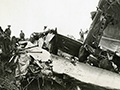
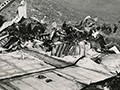
7x9-inch ACME Telephoto from the archive of the Illustrated Daily News' Los Angeles Bureau. Plane crashed 5-16-1938; photograph dated 5-19-1938. Cutline (see below):
LA448954
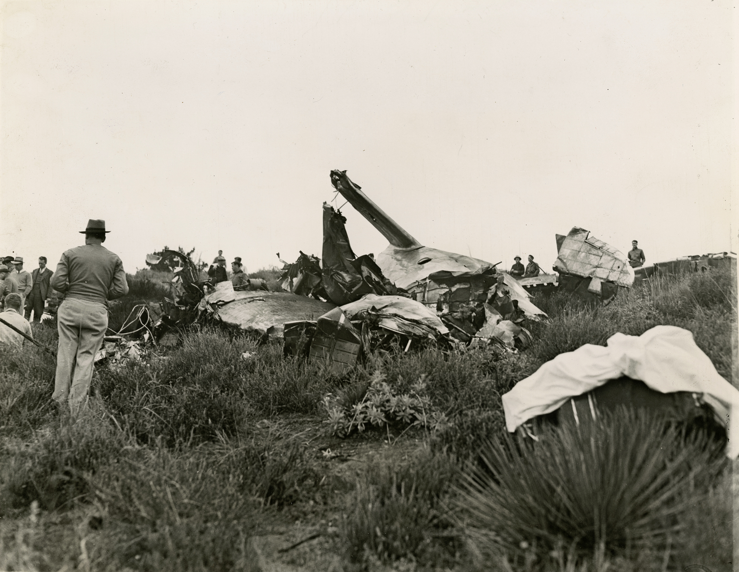
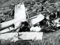
WRECKAGE OF AIRLINER IN WHICH NINE PERISHED SAUGUS, CAL. — A general view of the twisted and fire-scarred wreckage of the huge Lockheed transport plane which crashed into Stone Mountain, 20 miles north of here, while on a delivery flight from Los Angeles to Las Vegas, Nev. The sheet-covered body of one of the nine victims can be seen in the foreground. Credit Line (ACME) 5/19/1938 NY FOR 
From Aircraft Wrecks: 5/18/1938 [Error: s/b 5/16/1938]. Lockheed Super Electra Model 14H c/n 1439, NC-17394 of Northwest Airlines hit Stroh Peak 1.5 miles north of Mint Canyon Road, killing all nine on board. Bad weather was a factor in this crash. Wreck is mostly removed from its 2,200' impact site. From Aircraft Crashes Record Office: Date & Time: 16 MAY 1938 at 0207LT Type of Aircraft: Lockheed 14-H2 Super Electra Registration: NC17394 Location: Palmdale Schedule: Hollywood - Las Vegas - Minneapolis - Chicago Construction number: 1439 Year of manufacture: 1938 Crew on board: 3 Pax on board: 6 Crew fatalities: 3 Pax fatalities: 6 Other fatalities: 0 Total fatalities: 9 Circumstances: 24 minutes after its departure from Hollywood-Burbank airport, while cruising at night, aircraft hit Mt Stroh located in the Mint Canyon, southwest from Palmdale. Crew was performing a special flight to Las Vegas to show this new aircraft to the president of the company. All nine occupants were killed. Causes: Crew did not follow published procedures and was cruising at an unsafe altitude to overfly the mountainous region. From Aviation Safety Network: Date: Monday 16 May 1938 Time: 14:07 Type: Lockheed 14-H2 Super Electra Operator: Northwest Airlines Registration: NC17394 C/n / msn: 1439 First flight: 1938 Crew: Fatalities: 2 / Occupants: 2 Passengers: Fatalities: 7 / Occupants: 7 Total: Fatalities: 9 / Occupants: 9 Airplane damage: Damaged beyond repair Location: near Saugus, CA ( United States of America) Phase: En route (ENR) Nature: Ferry/positioning Departure airport: Burbank Airport, CA (BUR/KBUR), United States of America Destination airport: Las Vegas McCarran Field, NV (LSV/KLSV), United States of America Narrative: Struck Stroh Peak at 3,300 feet in Mint Canyon 27 minutes after taking off from Burbank Airport for Las Vegas and on the way to Saint Paul. The brand new Lockheed was on its delivery flight from Burbank to its new owners, Northwest Airlines. It was being flown by a Lockheed test pilot Sidney Wiley (36) and the vice-president of Northwest Frederick Whittlemore (42), who was a pilot. Flying in foggy conditions it struck the first of a series of ridges and bounced off two others, disintegrating on the way, before coming to rest and burning out on a hill called Stroh Peak.
LW2876: 9600 dpi jpeg from original photograph purchased 2017 by Leon Worden.
|
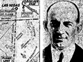
The Signal 5-19-1938 |
The site owner makes no assertions as to ownership of any original copyrights to digitized images. However, these images are intended for Personal or Research use only. Any other kind of use, including but not limited to commercial or scholarly publication in any medium or format, public exhibition, or use online or in a web site, may be subject to additional restrictions including but not limited to the copyrights held by parties other than the site owner. USERS ARE SOLELY RESPONSIBLE for determining the existence of such rights and for obtaining any permissions and/or paying associated fees necessary for the proposed use.
