|
|
Synergy-Brookfield LLC Keystone (Five Knolls) Subdivision
Appendix 4: Cultural Resources
Draft Environmental Impact Report | SCH No. 2004081017
Prepared for: City of Santa Clarita Planning & Economic Development Department
23920 Valencia Blvd., Ste. 302, Santa Clarita, CA 91355
APPLICANT: Synergy-Brookfield, LLC | 19200 Von Karman, 6th Floor, Irvine, CA 92612
Prepared by: Christopher A. Joseph & Associates | 31255 Cedar Valley Dr., Ste. 222, Westlake Village, CA 91362
July 2005
|
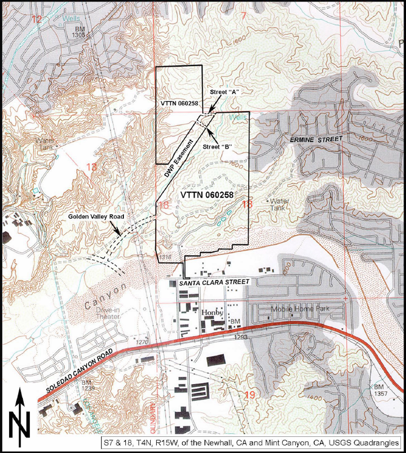
UPDATE The Draft and Final EIRs contemplate a few different project alternatives with various mixes of single-family and multi-family homes (as many as 833). The project plans as they exist now, 10 years later (2015), do not strictly conform to any of the alternatives. Instead, the applicant is pursuing development of 499 single-family homes. (Any more than 499 and a new EIR might be required.) CULTURAL RESOURCES: HIGHLIGHTS / EXCERPTS Paleological: Although no previously recorded fossil site is reported as occurring in the low terrace remnants in the parcel, fossilized remains representing an extinct species of Pleistocene bison (Bison) were recovered at one or two previously recorded fossil sites in this rock unit near the project site in the hills immediately northwest of the confluence of the Santa Clara River and Castaic Creek, and, if not in the underlying high terrace deposits, possibly near Castaic. Archaeological: The project site is split across two quadrangles: Mint Canyon and Newhall. A total of fourteen archaeological studies have been conducted within one mile of the project site, four of which include portions of the project site. One prehistoric archaeological site (CA-LAN-0295), two prehistoric isolates, and seven historical archaeological sites (CA-LAN-2105, CA-LAN-2132, and CA-LAN-2040 through -2044) have been recorded within one mile of the project area but not within the project site. A site reconnaissance revealed no evidence of prehistoric archaeological resources. Historical: the project site dominates the western half of Section 18. Research through the Bureau of Land Management General Land Office records revealed that the project site was subdivided and owned relatively early in California history. Some owners in the western half of Section 18 include:
In each case these were homestead records, suggesting there should be some evidence of improvements to the property(ies). Past quadrangles show structures and roadways in the area of the project site but none on the site. The current Mint Canyon Quadrangle illustrates a single structure in the southwestern corner of the project site and the presence of at least three ponds. However, a reconnaissance of the project site revealed no evidence of structures or ponds on the site and no other evidence of historic resources.

|
• Draft EIR 2005 • DEIR: Cultural Resources 2005 |
The site owner makes no assertions as to ownership of any original copyrights to digitized images. However, these images are intended for Personal or Research use only. Any other kind of use, including but not limited to commercial or scholarly publication in any medium or format, public exhibition, or use online or in a web site, may be subject to additional restrictions including but not limited to the copyrights held by parties other than the site owner. USERS ARE SOLELY RESPONSIBLE for determining the existence of such rights and for obtaining any permissions and/or paying associated fees necessary for the proposed use.
