|
|
The Trail to Kashtiq
By Dr. John R. Johnson
The Journal of California Anthropology | Winter 1978: Vol. 5, No. 2, pp. 188-198.
|
Webmaster's Note: Castac Lake, referred to in this article, is a naturally occuring body of water near Lebec, south of the Tejon Pass. It is not to be confused with the manmade Castaic Reservoir (Lake).
Considerable attention has recently centered on the linguistic affiliation of one of California's least known aboriginal groups, the native people who inhabited the upper valley of the Santa Clara River and the rough country northward to the vicinity of Tejon Pass. Traditional opinion has held that this territory was the homeland of a group of Uto-Aztecan speakers, who are known today as the Tataviam, and formerly as the Alliklik (Kroeber 1915, 1953:613-614, Pl. 48; Harrington 1935:84; Bright 1975; King and Blackburn 1978). Madison Beeler and Kathryn Klar in a recent article in this journal questioned the accepted interpretation. They suggested that the Tataviam, whose presence is postulated from fragmentary data, may not have existed at all, and assigned their territory instead to speakers of Ventureño Chumash (Beeler and Klar 1977).
This conclusion drawn by Beeler and Klar is based in part on the fact that a modern place-name of undisputed Chumash origin, Castaic, exists in the upper Santa Clara River valley right in the center of territory previously believed to have belonged to the Tataviam (Beeler and Klar 1977:303). They assume, as have many anthropologists before them (e.g., Kroeber 1915:774, 1953:Pl. 48; Johnston 1962:9; Bright 1975:229), that the original village of Kashtiq must have been located in the vicinity of the modern town of Castaic.1 This assumption is reasonable in light of the fact that the town of Castaic is located at the mouth of a creek by the same name, and it was the "general custom of the California Indians to name streams after the sites at their mouths" (Kroeber 1953:547).
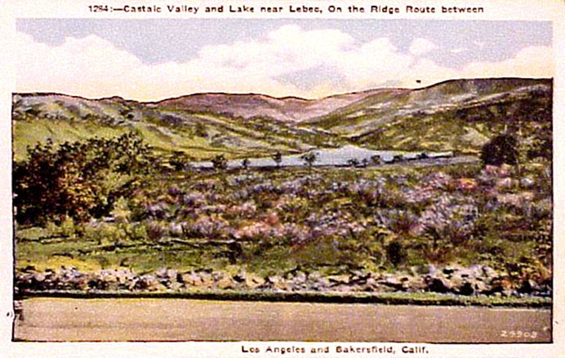
But the mouth of Castaic Creek is not the only location identified with the site of Kashtiq. On a map of historic Chumash settlements, Chester King places Kashtiq at Castac Lake which is located near Tejon Pass in territory well documented for the Interior Chumash (King 1975; Kroeber 1907:137-138, 1953:Pl. 48; Merriam 1967:430; Latta 1977:264; Beeler and Klar 1977:294). A Historic Period archaeological site is known for the latter location (Jennings 1976). Enough ethnohistoric and ethnographic data exist to clarify the Kashtiq issue, but such data have never been presented fully. The appearance of Beeler's and Klar's article makes an evaluation timely.
What follows will be an attempt to settle the problem of the original site of Kashtiq by (1) examining the available evidence and (2) by offering a hypothesis to explain how the name came to be applied to two widely separated localities. A final section will present recently discovered evidence which hints that expanded boundaries for the Interior Chumash may be in order, but not so divergent as those proposed by Beeler and Klar.
THE CHUMASH ORIGINAL
Part of the ambiguity surrounding the location of Kashtiq may stem from the way native speakers applied the term. There are hints in the notes gathered at Tejon Ranch by J.P. Harrington that Kashtiq may have been a general Ventureño name for any pond or small body of water (Harrington 1917a:1545). Kashtiq means "what is like a face, or an eye" (Beeler and Klar 1977:302).2 Thus, it may be similar in application to the old California Spanish expression ojo de agua, meaning "an eye, reflection, of water", referring to a spring (Latta 1976:108). In fact, one of Harrington's Ventureño consultants, Candelaria Valenzuela, stated that Kashtiq meant "spring" and that the village became so named because "there used to be a spring there" (Harrington 1916).3
CASTAIC (CREEK) VS. CASTAC (LAKE)
In determining the original site of Kashtiq we must rely on ethnohistoric sources. For an Interior Chumash settlement, Kashtiq was fairly large with an estimated population of over one hundred (King 1969). Converts from Cashtec or Caxtec appear in the baptismal registers of three missions, San Buenaventura, Santa Barbara, and San Fernando (Merriam 1962, 1968, 1970). We would expect that such an important ranchería would not go unnoticed by Spanish travelers to the interior. Records of its location should appear in official diaries.
A number of early historical accounts mention the existence of native villages in the Castaic Creek vicinity. The Portolá expedition in 1769, Father Garcés in 1776, and Father Santa Maria in 1795 encountered populous rancherías there, but unfortunately did not record their names (Bolton 1927:153; Coues 1900:267-268; Engelhardt 1973:8). By 1803 the padres of Mission San Fernando constructed an estancia called San Francisco Xavier on the mesa behind Castaic Junction. What is of interest to the present study is that the native name repeatedly associated with the San Francisco Rancho is not Chumash at all, but Uto-Aztecan! Chaguayabit (or Chaguaianga4), not Cashtec, is the name which is given (Engelhardt 1973:16, Perkins 1957:102, Merriam 1968:95).
In contrast to the absence of data favoring a Castaic Creek location, there exists a wealth of ethnohistoric information referring to a village named Kashtiq near Tejon Pass.5 Two expeditions in 1806 found a "moderate-sized" settlement at a lake of "pure salt water" (Castac Lake). The diarist of the first expedition, Father Zalvidea, recorded the name of the settlement as Casteque (Cook 1960:247,253). This form of the name for Kashiq is remarkably similar to the place Castequi, which appears in the Pico-Henshaw list of principal Chumash rancherías in the interior mountains6 (Heizer 1955:196, 1975:77).
The unpublished official file of an even earlier expedition of 1790 mentions that 39 natives of "Castec" participated in an attack on a party of soldiers in nearby San Emigdio Canyon.7 They were in company with Yokuts from the villages of "Loasi" (Loasu) and "Mitunami" (Tulamniu), and Chumash from "Taxilipu" (Tashlipan, San Emigdio), "Matapuan" (Malpwan, Santiago Creek), "Taxicoo" (Tats'ik'oho, Pastoria Creek?) and others. It is significant that most of the villages which can be identified were in the southern San Joaquin Valley and neighboring mountains (King 1975; Kroeber 1953:Pl. 47). None can be linked with the upper Santa Clara [River] valley. In 1838, the San Fernando Mission baptismal record shows two neophytes from Castech en los Tulares, again associating the Kashtiq ranchería with the San Joaquin region8 (Merriam 1968:95).
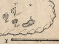
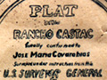
Nineteenth-century Mexican land grants provide further clues to the original location of historic villages by preserving native place-names either in the names of the grants themselves or in the diseños, which are maps showing topographic features in the areas applied for. The Castec grant originally covered the territory from Castec Lake down the Cañada de las Uvas to the shores of Kern Lake9 (Becker 1969). Bordering to the south was the Los Alamos y Agua Caliente grant. The diseño of the latter shows the Lomería de Castac as the low hills lying just north of Gorman Creek and identifies Tejon Pass as Portezuela de Castac (see Table 1).
Later nineteenth-century evidence also links the Kashtiq name with the Tejon Pass area. The Pacific Railroad Survey of 1853 gives Casteca as an early form of Castac Lake (Blake 1856:47). The "Castake" tribe appears in 1851 among the southern San Joaquin tribes signing the "Texon" treaty (Heizer 1972:38-39).
Ethnographic notes from the early twentieth century provide further clarification. Kroeber's and Merriams's consultants at Tejon Ranch stated that Kas-tuk, or Kas-tak, was at Castac Lake at the head of the Cañada de las Uvas (Kroeber 1915:774; Merriam 1967:435; Beeler and Klar 1977:299). However, Harrington's principal Inezeño consultant, Marla Solares, who had visited Tejon as a child (Blackburn 1975:18), remembered Kashtq as being a place at the mouth of Cajon de las Uvas, called by the Yokuts Lapnaw (Harrington 1916). From other sources, we know that this was instead the historic Chumash village of Mat'apxwelwxwe'l10 (Applegate 1975:36; King 1975; Latta 1977:270; Harrington 1917a:1537), which means the same as the Yokuts' Lapnaw or Lapiw, "Cottonwood Place." However, Maria Solares was right insofar as the people of Lapiw were said to be of the "Kas-tak tribe" (Merriam 1967:435).11
To summarize, all indications are that Kashtiq was located at Castac Lake. Conversely, nowhere in ethnohistoric documents is the name associated with the mouth of Castaic Creek.
PATTERNS OF PLACENAMES
Earlier, a passage from Kroeber (1953) was quoted which indicated that in native California canyons frequently became named for settlements at their mouths. A second pattern of place naming, commonly applied by Euro-americans during the nineteenth century, also became preserved on twentieth-century maps. Those canyons which were along major travel routes came to be named for the destinations of the important trails which followed their courses, similar to the way modern freeways, radiating from Los Angeles, have acquired their titles. An example in the mountainous interior of Santa Barbara County may be cited. Santa Barbara Canyon, a tributary of the Cuyama River, was so named because it provided an important corridor in historic times (and prehistoric) through the mountains to Santa Barbara (Gifford and Schenck 1926:16; Smith 1973; Cook 1962:156; Spaulding 1966:11).
An examination of any modern map of the region reveals that Castaic Creek also may have once provided a way to Tejon Pass at the top of the Cañada de las Uvas, and thus became named because it was the trail which led to the region associated with the "Castake tribe," Castac Lake, and Castec Land Grant. To see whether such a route was actually in use, we may turn again to some early records.
The Wheeler map of 1879 shows very clearly that the Castaic Creek trail was one of major importance during the nineteenth century. Evidence that the trail continued to be used into the early twentieth century appears on the first map (1902) of the Pine Mountain and Zaca Lake Forest Reserve (later to form portions of the Los Padres and Angeles National Forests). Eventually segments of the trail became worked into a paved road which today is Interstate 5, the main artery connecting the northern and southern parts of the state.
If we go farther back in time, we find that the trail was in use by the Spanish early in the nineteenth century. Pablo de Portilla, en route to San Emigdio to retrieve runaway neophytes who fled during the 1824 Chumash revolt, gives us an accurate description of the trail:
June 7 We left Espíritu Santo and traversed rough hills, then a rocky gorge with considerable water called the Tinoco [Piru Gorge],12 as far as the place known as Los Alamos [still called Catñada de los Alamos], a distance of perhaps 8 leagues. We continued through a plain [Hungry Valley], passed by the Salinas de Cortes [Castac Lake],13 and entered Grapevine Canyon in the middle of which we made camp. ... It is 6 leagues distant from Los Alamos [Cook 1962:155].
Other expeditions had taken the same route as Portilla or one very similar. Moraga's 1806 expeditions apparently came this way, as did that of Palomares in 1808 and others (Cook 1960:253-5; Cutter 1950:53, 147). We might infer that the trail was of major importance in prehistoric times as well,14 and that the frequency of commerce which came this way was what made the people of Kashtiq seem "altogether too cunning and crafty in trading" (Cook 1960:253).
Further data regarding the Castaic Creek trail has recently come to light among the ethnographic field notes of John P. Harrington (1917b).15 From a notebook kept by Harrington during a place-name trip with Eugenia Montes, a Kitanemuk consultant, come more details about an old trail used by the Indians when Eugenia was a child. Traveling over the old Ridge Route with Harrington, Eugenia pointed out those places which she remembered. The trail she described is different in some ways from the route we have come to know from the diaries of the Spanish colonial expeditions and from the 1879 Wheeler and 1902 Forest Reserve maps.
Beginning at the mouth of Castaic Creek, she named tsaway'ung for an aguage (watering place) below Newhall.16 Pi'ing was a ranchería located upstream from where Violin Canyon entered Castaic Valley.17 The Indians' trail apparently went up Violin Canyon and climbed a mountain called kikitiking (Townsend Peak?) where another trail was met from the lower Piru. From here the trail went over to "Los Alamos" where the ranchería of Pakung once stood. Eugenia had once attended a fiesta there. En route from "Los Alamos" to La Liebre, shraqang (Quail Lake) was passed as was timkiyik, a cave with a spring. From hwi't ahovea (La Liebre Ranch House) there were trails which led across the west end of Antelope Valley. One went up hunaiyik (Oso Canyon) and then passed the east shore of Castac Lake. A second trail led northward crossing twoo ridges before descending La Tunas" (Tunis Creek) to Tejon Ranch (Harrington 1917b).
Only a few selected place-names mentioned by Eugenia have been presented here. Further analysis is needed to identify others which were recorded by Harrington. What is important to the present study is the fact that a trail leading up Castaic Creek was known and used by Kitanemuk who lived at La Liebre and Tejon Ranch during the historic period, and that one branch of the trail led past Castac Lake.
So far we have discussed evidence which makes a hypothesis of Chumash ownership of the upper Santa Clara highly suspect. Next we will consider data which expand our understanding of the territory the Chumash may have held.
ETHNOHISTORIC DATA FROM LAND GRANT DISEÑOS
Los Alamos y Agua Caliente is a place-name found on modern maps for an angular tract of land arranged around Pastoria Creek in the southern Tehachapi Mountains. Actually, the final United States government survey for the Los Alamos y Agua Caliente land grant moved it to a completely different territory than is shown on the original diseños. The reason for the relocation was given by J.J. Lopez, former mayordomo of the Tejon Ranch:
[The] grant was intended to be located between Hungry Valley and the Frazier Mountain on the west, the Alamos mountains on the south, the Siete [sic] de la Bellota ... on the east,15 and the divide between Gorman Station and Fort Tejon on the north. ... General Beale [then Surveyor General of California] floated it between the Tejon and the Castaic [sic] (which he also owned) so as to give him an unbroken body of land19 [Latta 1976:193].
With this introduction, we may next examine carefully some Indian place-names which appear on Los Alamos y Agua Caliente diseños (Table 1). The interested reader may also consult Becker's (1964) reproduction of one diseño and should bear in mind that his identifications differ from those suggested here, since he was attempting to reconcile features on Beale's misplaced grant with topography shown on the original diseño.
Table 1 presents place-names of Indian origin with a preliminary linguistic analysis. The names are clearly derived from a Chumash language and constitute evidence of Chumash presence in territory not previously known for them. The region encompassed by the Los Alamos y Agua Caliente diseño was originally assigned by Kroeber to the Alliklik (Tataviam). King's and Blackburn's recent summary also included this area in northern Tataviam territory (Kroeber 1953:Pl. 48; King and Blackburn 1978). With the ethnohistoric information available from the land grant diseño, we have indications that the Tataviam linguistic boundary might be adjusted southward at least to the confluence of the Cañada de los Alamos and Piru Creek, giving the upper Piru, Hungry Valley, and Gorman Creek to the Chumash. The recent work of Horne, Craig, and King (n.d.) seems to confirm this hypothesis.
CONCLUSION
This paper has attempted to show that the place-name Castaic is a historic introduction to the upper Santa Clara River valley. Castaic Creek was so named because it provided a natural travel corridor north to the site of the Chumash village, Kashtiq, at Castac Lake. Thus, the existence of the name Castaic in the upper Santa Clara River Valley does not justify assigning this territory to the Chumash. In fact, experience shows us that just because a modern town possesses a Chumash name, it does not necessarily mean that the village of that name was located nearby. Two examples are modern Somis, east of Saticoy, and Ojai in the Lower Ojai Valley. The Ventureño village of S'omis was originally near present-day Ojai, and 'Awha'y itself was actually situated in the Upper Ojai Valley (Applegate 1975:42; King 1975; Harrington 1916).
Land grant diseños frequently provide valuable ethnohistoric data by recording early Hispanic and Indian place-names which later fell into disuse (King 1975:171; Glassow and Horne 1976). The diseño for Rancho Los Alamos y Agua Caliente has on it a number of Chumash-derived words. This evidence suggests that a redrawing of the linguistic boundary between the Tataviam and Chumash may be in order. However, caution should be used in even accepting a modest readjustment of boundaries. Kitanemuk place-names are also known for the Gorman-Los Alamos area (Harrington 1917a, 1917b), and two Kitanemuk consultants, Juan José Fustero and Eugenia Montes, provided evidence which seems to assign that region to the Tataviam (Kroeber 1915:774; Bright 1975:229). The proposal that the Chumash held a larger territory must be considered only a hypothesis for the present. Further testing can be provided by an in-depth analysis of Harrington's field notes, especially those from José Juan Olivas, a Castac Chumash consultant, and Eugenia Montes. Mission register analysis is another hopeful area to be explored.
ACKNOWLEDGEMENTS
The author expresses his appreciation to the following persons who generously provided or helped to locate some of the source material used in this paper: Stephen Horne, Steve Craig, Chester King, Thomas Blackburn, Dick Whitehead, Donald Cutter, David Jennings, Clifton Smith, and Alexa Luberski. The author originally became interested in the Tejon Pass region while conducting background research for U.S. Forest Serviee arehaeological reports.
Los Padres National Forest, Goleta NOTES
1. The orthography used here for the Chumash name Kashtiq is that suggested by Applegate (1975:24). In 1960, the Geographic Board distinguished between the two modern versions of this place-name, settling for Castaic Creek, Valley, and town in Los Angeles County, as opposed to Castac Lake and Valley in Kern County (Gudde 1969:57).
2. The Yawelmani Yokuts name for Kashtiq was recorded by Merriam as Sahs which meant "eyes" (1967:435). Kroeber's Yokuts consultants at Tejon gave him the place-name Sasau for Castac Lake which meant "at the eye" (Kroeber 1907:139).
3. This piece of information clears up one nineteenth-century reference which until now was puzzling. In 1824, Pablo de Portilla, returning home from San Emigdio by way of Santa Barbara Canyon, "camped for the night at the place called Casitec (or by us San Pablo)" (Cook 1962:156). Casitec was most likely a spring, located somewhere near the headwaters of Mono Creek, perhaps in Alamar Canyon or Don Victor Valley. Portilla's "Casitec" has previously been confused by several authorities with the village of Kashtiq (cf., Gudde 1969:57; Brown 1967:18).
4. Cf., Tsawayung, name for a village on the San Fransquito Ranch near "Castac depot" (Kroeber 1915:774; King and Blackburn 1978).
5. Tejon Pass, as it appears here, refers to the place so designated on modern maps at the top of Grapevine Canyon (Cañada de las Uvas). The original Tejon Pass was in the Tehachapi Mountains at the head of Tejon Creek, which enters the San Joaquin Valley at Tejon Ranch (Williamson 1856:23).
6. Pico's Castequi was unfortunately misprinted by Heizer as "Las tezui," an untranslatable word. The error is understandable given the difficult handwriting in the Henshaw manuscript. A similarly garbled rendition of Casteque may occur in a published reminiscence of an early nineteenth-century expedition originally collected by Alexander Taylor (Cook 1960:255).
7. The 1790 incident in which two soldiers were killed is referred to repeatedly in early diaries. The best summary of the affair occurs in Cutter (1950:42-47). A brief notice is given by Bancroft (1886:465). The full account has recently been translated and is being prepared for publication.
8. In the nineteenth century, Chumash villages in the mountains near the southern San Joaquin Valley were often grouped with the Yokuts by the Spanish as Tulareños.
9. The official description of the Castec grant preserves the old Spanish place-name for Castac Lake — Salinas de Cortes. The origin of this name can be traced back to Pedro Fages, who became California's first governor. In 1772, he was the first official Spanish visitor to enter the southern San Joaquin Valley. He called Tejon Pass the Portezuelo de Cortes apparently with an eye towards political considerations in Mexico (Bolton 1931; Crowe 1957:22). Early travelers in the 1800s also mention the Salinas de Cortes (Cook 1960:255; 1962:155).
10. Mat'apxwelexwe'l gave at least two early baptisms to Mission San Buenaventura (Merriam 1970:44) but is conspicuously absent in the reports of various early expeditions which traversed Grapevine Canyon. However, by the late nineteenth century there is abundant evidence of a ranchería at this location (Kroeber 1953:Pl. 48; Blackburn 1975:272; Williamson 1856:Pl. 7; Blake 1856:41; Crowe 19S7:37; Latta 1976:207; Voegelin 1938:51).
11. For other early references to a Castac "tribe" see Heizer (1972:39) and Giffen and Woodward (1942:30).
12. See Table 1 for identification of the Tinoco.
13. See Note 9.
14. Kroeber stated that the Castaic Creek trail was probably an important thoroughfare for Indians traveling to the San Joaquin Valley (1915:774).
15. See Horne, Craig, and King (n.d.) for a discussion of other data contained in Harrington's notebook.
16. See Note 4 and compare discussion of Chaguayabit in the text of the article.
17. Cf. Piibit or Piinga of the San Fernando Mission records (Merriam 1968:99). The location of this village is shown by King and Blackburn (1978). Like Chaguayabit, another Uto-Aztecan name for the Castaic Creek region!
18. The Sierra de la Bellota is apparently meant. Bellota means "acorn." The same place may have been referred to by Eugenia Montes who pointed out a mountain with "bellota trees" (K. kwiyitshr) on top to Harrington while they traveled the old Ridge Route (Harrington 1917b). Perhaps the name refers to Bald Mountain. A field check is needed.
19. It has been said that when asked why he did not reappoint General Edward F. Beale as Surveyor General for California, President Lincoln remarked, "He became monarch of all he surveyed (Crowe 1957:67).
REFERENCES
©1978 Malki Museum Press · Reprinted by Permission.
|
• Johnson: The Trail to Kashtiq
Map ~1842
Beale Map 1862
News Item 11-22-1915
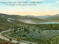
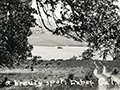
Real Castaic Lake 1919x2
Real Castaic Lake 1920s
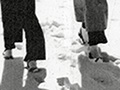
Snowman 1922
Legend of Indian Massacre, News Report 1927
Real Castaic Lake 1930s
Real Castac Lake ~1930s
Snowfall 10/1949 x2
Wines Richfield
| |||||||||||||||||||||||||||||||||||||||||||||

The site owner makes no assertions as to ownership of any original copyrights to digitized images. However, these images are intended for Personal or Research use only. Any other kind of use, including but not limited to commercial or scholarly publication in any medium or format, public exhibition, or use online or in a web site, may be subject to additional restrictions including but not limited to the copyrights held by parties other than the site owner. USERS ARE SOLELY RESPONSIBLE for determining the existence of such rights and for obtaining any permissions and/or paying associated fees necessary for the proposed use.
