|
|
Vasquez Rocks, Land of Enduring Romance.
By Jo Ellen Rismanchi.
SCVHistory.com | January 2, 2002
|
"Agua Dulce" — "sweet water" — was the name given by the Spanish missionaries who passed through the canyon in northern Los Angeles County that borders, at its heart, Vasquez Rocks County Park, which was in turn named for the last great Californio bandit, Tiburcio Vasquez. This article will briefly discuss the following aspects of Vasquez Rocks history: its geology, Native American history, the Rancho period, the homesteading period until 1967 — when it again became government property — and the reason it took on the name of a notorious outlaw. Geology Magnificent south-facing hogback ridges reach out at a 45-degree northerly angle toward the sky much like a hand seeking to shake another. Who would guess, looking at the surreal Vasquez formation cradled in the Soledad basin, that a violent earthquake created it some 25 million years ago? At the western edge of the park lies the San Gabriel mountain range; to the north, the Sierra Pelonas. Getting caught in the squeeze between these two major mountain ranges caused the magnificent Vasquez formation to take its shape. Visitors can marvel not only at the entire vista, but they also gain insight into prehistoric weather patterns if they look closer and examine the differences in the thick and thin layers of sandstone and conglomerate — thicker layers having formed in wet years and thinner layers in dry years. But its geology is just the beginning of this park's intriguing history. Early Inhabitants The U.S. General Land Office conducted a survey between 1850 and 1870, after California became a state. Surveyors made money based on acreage covered, so the flatter lands were done earlier because they were more profitable.[1] Vasquez Rocks was part of the land that was granted first to the Atlantic & Pacific Railroad (which built no tracks in the area). Within weeks, another claim was recorded by the Southern Pacific Railroad, which simply went ahead and laid its tracks prior to filing. Homesteading was effectuated by running the railroad tracks through Soledad Canyon in the 1870s. Because Southern Pacific had built its route, in 1876 it filed a petition to have its claim inspected. Southern Pacific received title to 20 acres on either side of the tracks, at odd-numbered sections. Of course, the railroad took the land that had available water.[2] In 1886 the Department of the Interior invalidated Southern Pacific's claims because of Atlantic & Pacific's prior claim. But since the Atlantic & Pacific never built track, the Interior Department determined the transfers were null and void. Congress ultimately cancelled land grants to the railroads in California. As a result, some of the land that was homesteaded became private while the remaining odd-numbered sections became part of the Santa Barbara National Forest (later the Angeles National Forest, when the Santa Barbara was split into the Angeles and the Los Padres). The Big Four of the Southern Pacific — Huntington, Stanford, Crocker, Hopkins — filed 12 separate lawsuits and went all the way to the U.S. Supreme Court, only to lose to the federal government. And so it is that some of the land became private, such as Vasquez Rocks, while other sections became national forest. The placement of train tracks was not likely circumstantial. Rather, the 1850s and 1860s brought mining to the area. A camp moved from strike to strike with each new discovery of ores, among them gold, silver, copper and magnesium. Initially called "Soledad City," the camp took the name of Ravenna when the U.S. Postal Service decided the original name would be confused with the northern city of Soledad. In the 1860s and 1870s Ravenna's location became more static and a train station was set up there, in fairly close proximity to Vasquez Rocks. Much earlier, the park was home to native Americans. The first humans arrived in the area some 13,000 years ago, and artifacts have been found in and around Vasquez Rocks that have been carbon-dated 8,000 years ago — an age comparable to the earliest knowledge of the Egyptian empire. While the identity of the earliest inhabitants is not known, a group that called itself Tataviam, or "People of the Sunny Slopes," took up residence some 1,500 to 2,000 years ago. (Sometimes these people are referred to as Alliklik, which was actually a derogatory term coined by their Chumash neighbors, deriding what seemed to the Chumash to be the clicking or stammering sound of their language.) The Tataviam were a Shoshone people who belonged to the Uto-Aztecan language family. While descendants may number in the low thousands today, there are no remaining Tataviam speakers and only 13 words of their language are known. Pictographs at Vasquez Rocks, left behind on rock faces and in small caves, suggest the area may have held religious significance. Archaeological evidence also indicates Vasquez Rocks was a major crossroads where north-south and east-west trade routes converged. Early inhabitants in and around Vasquez Rocks had a varied diet that included bulbs, roots, seeds and meat. Three plants were mainstays: Desert Valley chia, juniper berries and yucca roots. Local vegetation was lush. Desert Valley chia, sage seeds and acorns were available in abundance. The stems of the Desert Valley chia host several square pods that were harvested for their seeds. About one-quarter the size of a sesame seed and with a taste not unlike English walnut, the dark, sage-green chia seeds were leached and separated from their chaffs. With a shelf life of 20 years or more, two teaspoons of chia seed provided enough protein and nourishment to satisfy one person daily. The chia plant appears in early spring and is more abundant in seasons with heavy rains, although even without rain, the hardy plant flourishes. Native American runners consumed this food before their daily 50-mile runs. Another plant consumed by the Tataviam was the juniper. Ripe berries were harvested below the trees and were eaten much like raisins are consumed today. The berries underwent a drying and fermenting process in which the turpentine that makes a fresh juniper berry inedible is evaporated away. The sugars are activated in the process, and what remains is a sweet berry similar to a raisin — although slightly different in taste. The third plant commonly consumed was the yucca root. Just before it was about to bloom — at the ripest and tastiest stage in its life cycle — the plant was abutted with rocks to control its growth; the plant was then killed and harvested for its root. The root was then fired for three days in a subterranean rock-earth oven. Once cooked, the yucca has a shelf life of two years. Harvested roots were stored in underground baskets that sat on a tripod of rocks. Ash was scattered among the rocks as a preservative, controlling moisture and fungus and preventing insects from consuming the food. Local inhabitants also ate deer, rabbits, antelope and elk when available. Meat was most likely not consumed daily; perhaps only three times a week. Porridges derived from chia seeds and yucca roots were the staple. The Portolá expedition came through the area in 1769, followed by the DeAnza party in 1774, marking a turning point for the Tataviam people. Inhabitants were rounded up and taken to the Mission San Fernando Rey de España where they were absorbed into the Spanish mission system and forced to work the chuch-owned lands. Bloodlines were diluted as Indians intermarried with members of other tribes who had been similarly conscripted. The Mexican revolutionary period of the 1820s and 1830s saw the relinquishment of the lands by Spain, but secularization dealt the Tataviam a further blow. Lands were not returned to their original inhabitants; rather, they were parceled out, usually in 48,000-acre allotments, in the form of grants to powerful and influential Mexican dons. Indians were frequently swindled of forced to flee; many were killed as squatters even into the American period. Some were hired by ranch owners such Edward Fitzgerald Beale, President Lincoln's Surveyor General for California and Nevada, who amassed a huge land holding in the area. Beale, who became head of the Bureau for Indian Affairs, is looked on kindly today — unlike some settlers of the time — because he established the first reservation and made sure his Indian ranch hands were fed. Each Christmas, Beale reportedly gave each family a side of beef. The Homestead Period and the Krieg Family Henry Krieg, a miner from Cripplecreek, Colo., moved to Agua Dulce in 1909. For a time, Krieg, who dressed in a blue shirt and khakis, worked for the Sterling Borax Co., which extracted borates from nearby Tick Canyon. Krieg's job was to erect timber supports in the Borax mine. Desiring land of his own, Krieg decided to homestead Vasquez Rocks. "All of the neighbors poked fun at Mr. Krieg about what he was going to do with 'a pile of rocks,' or, 'What's Henry going to grow? Rocks?'" said Mary Wright, the daughter of neighboring homesteaders Lula Chabbell Johnson and Ulysses Sumner Grant Johnson, who had moved their entire family by wagon through Beale's Cut from the Los Angeles suburb of Sawtelle in 1914. For all of the teasing he received, Krieg was quite enterprising. He built cabins that he rented to weekend visitors — although not all of his tenants were strictly weekend visitors. Krieg had a dam, built by Robert R. Bryant[6], that was a water source for everyone who lived on his property. The dam doubled as a swimming hole for children.[7] Krieg's ranch caretaker, John Wagner, sat in a car near the entrance of the park, sometimes accompanied by Letty Dyer, to collect an entry fee of 25 cents per car for visitors to see the rocks. During the Great Depression, 25 cents represented about an hour's worth of labor for the average worker. Homesteaders were required to plant five acres for three years to keep their homestead claims. To "prove up" his homestead claim, in the flat area south of the pepper trees that stand near the public parking lot today, Krieg planted apples and pear trees. There he found a natural spring, and seeking its source he tunneled through solid rock into the mountain, where intercepted several springs that became his water source. Krieg's brother and a man named Adolf, a welder, ran a pipe from the spring to water the field of trees.[8] Today some local residents recall a fort built as a movie set in the same location. President Woodrow Wilson signed Krieg's homestead deed in 1919, granting him a patent to most of what is today Vasquez Rocks County Park easterly from the ranger's house. Krieg was a landlord and subdivider. He would sell off his land, an acre or two at a time. Homes being more valuable than land in Krieg's day, homeowners would frequently take their houses with them when they moved on, abandoning the land that was to them a tax liability. Krieg would resume paying the taxes and re-acquire his former property. Krieg remained a bachelor all of his life. The days of the depression were poor ones for Henry Krieg, Krieg's sister Ida Krieg Faulbert, his brother-in-law Joseph Faulbert and tenant/friend Earl Casey. "My father and my father's twin brother were born in Como, Colorado. Two years after my father was born his father Albert H. Toney was killed in a coal mine. My grandmother remarried Joseph Faulbert," said Faulbert's grandson, Ed Toney. From their pristine view, the remains of the Krieg family preside over the Rocks and its visitors today. Another woman named Mattie Fox died and was buried there in the Rocks during the 1930s. The Fox family rented a cabin from Krieg. They were known for throwing garden parties until Mrs. Fox died and the family moved on. The remains of these people are still interred in the rocks to this day. While America was sunk in the Great Depression, Vasquez Rocks was no different from the rest of the country grappling with the issues of prohibition and poverty. Krieg had his own still for making whiskey. The grapes were supplied by Tall Bello, a farmer who grew them locally. Krieg owned a press to make the grapes into wine. Indeed, there were other bootleggers who rented space in the local area only to be run off by law abiding families of the time like Tony and Geneva Dean Held. Krieg's nephew, Ed Toney said as a boy he was not allowed anywhere near the still. Toney himself admitted that he didn't particularly like being around the still because, "it smelled." The family's diet was simple in those dark days of depression. Breakfast consisted of oatmeal, lunch was fried oatmeal topped with maple syrup, and dinner was beans. Occasionally, Ed would catch a deer or some quail or a small rabbit for meat to add to the family meals. Hollywood came, not only to make moving pictures — but some came to stay. One well known actor who came to stay and rented one of cabins owned individually at the Rocks was Cy Young. Henry Krieg would sell small subdivided one-acre portions to people. One such site was owned by Ray Rademaker who sold the property to actor Cy Young and his wife. On the left side of Escondido Canyon Road, just north of the entrance to Vasquez Rocks was Ben Trueax's home. Trueax was the engineer for the local narrow gauge train that ran between the borax mine at Tick Canyon and Agua Dulce. Income also came to the family through renting to movie studios, renting out weekend cabins and some occasional gold mining. Although some of the gold that Krieg and his father Ray Toney found came from abandoned Mexican arrastras. The family also had a mine at the end of Darling Road. Their gold mining operation went 140 feet down into the ground until World War II intervened and dynamite was no longer available. The Toneys owned a dry washer and mined for gold along the creek. "The Rocks" as they were known in those days, were popular not only with the movie industry but artists as well. Ed recalled local artist Claude Ellis. He worked for the Fuller Paint Company. Ellis tested various brands of paint at Vasquez Rocks. He used to camp out across the street until Ray Toney gave him a one-acre spot. The Indian paintings mark the site today of Mr. Ellis' cabin. Ed says he painted not only on rocks but on tree stumps too. Eyeballs were painted in rocks. The monster rock visible today only by its eyeballs was a much more elaborate painting. The monster had hair and it was very well defined. The monster rock and the paints of the bandit are all near the front of the park. The location where the so-called Indian paintings are located in an area named "the Devil's Punch Bowl" by Henry Krieg. Krieg himself lived in a cabin near the peppertree. The cabin was interesting and also strange. Inside the cabin, furniture was sparse. Ed recalls a wood stove and a kitchen table. The legs from the table were placed in tin cans filled with water for pest control. Krieg kept the ants from crawling up onto the table. He also had an old wood stove. The cabin sat on boulders, but was built out of board and bat. According to Ida Toney, Krieg "walked like a bear." He was a wild man. Ed said except for the fact that he owned the Rocks, Krieg probably would have followed his friends to Alaska. Toney was critical of Krieg's drinking and spoke about one instance when it negatively impacted his the family. Krieg had taken a wagon out to Mohave towards Death Valley to purchase supplies. He stopped at Reno's Bar to have a drink. While he was there, someone came up behind him, slapped him on the back and said, "You're buying drinks for the house." Krieg looked down and saw the bar was full and he had to buy drinks because the man was packing lots of guns. It turned out that the man who slapped Henry on the back was the Mohave Kid. With an empty wallet and lighter head, Henry arrived home without his supplies. When prohibition ended, Ed Toney and his father were given a still that had been kept by Howard Hughes in the basement of his Los Angeles home. Ed recalled that he and his father extracted the copper liner inside the still, and then sold it for an "obscene" amount of money. Then they took the wooden slats of the tank apart and reconstructed it upon cement footings at Vasquez Rocks to make a water tank. The county not realizing the historical value of the water tank disassembled it as a hazard. Today, the cement footings from this tank are still visible in the park. Letty Dyer Foote's grandparents, J.T. and Mary Dyer lived in one of Mr. Krieg's cabins. Today, the only remaining marker of the site that once marked their cabin is a short wall and a small s-curved hot wheels track, traced in cement. The track kept the Dyer grandchildren busy for hours. Foote's grandmother, Mary Ritter Dyer eventually died in her home at the Rocks in 1945. Mary Ritter Dyer is not buried at the Rocks but at another historic cemetery in the local area, the Mitchell-Dyer family cemetery next to her husband, "J.T." or James Thomas Dyer, who died in 1960. Another small visual reminder of life that once settled in at the Rocks is a small protruding pipe near the great pepper tree picnic area. The pipe was part of an elaborate solar water heater and shower for Aqua Dulce School teacher Grace Heath. That pipe ran water into a metal water barrel that was mounted on platform exposed to the sun. Exposure to the sun in that metal container that caused the water to heat. Grace Heath taught at Aqua Dulce school-exactly how long is not known, but the photo attached to this story shows Ms. Heath and her class out at the Rocks — taking a day off from school to watch a film production one wonderful day in 1934. Posed in the photo with Ms. Heath and her class are cowboy actors Richard Dix and Fred Kohler in the front, real Indians working in the production and in the background at the top are John Mitchell and the cows he rented out for that western movie. The area where the park entrance road is today, Ed Toney purchased from a man named Mr. Schreiber. The recurring theme of property taxes came full circle in 1967. What at one time became incentive for the government to make the land available to homesteading now served as the reason for the family to sell the land back to the government. The Toney's sold the property to the County of Los Angeles because the taxes made the property unaffordable. Ed Toney received $90,000 for the portion of land he had purchased from Mr. Scribner; and his Mother, Ida Toney received $260,000. They leased the land to the County in 1965 and when the SKAG program was developed, the County of Los Angeles purchased their beloved Vasquez Rocks property in 1967. Initially, Toney was bitter over giving up The Rocks. However, many years later Toney said he was glad that the County ended up with the property. One developer who approached his family wanted to paint all of the rocks white and re-name the place, "Moon Valley." Toney felt the County was a better choice. The home Ed Toney once built with his father Ray from leftover movie prop lumber became home to the first park ranger, Ernest Burwell, his wife Helen and their two sons David and Wayne. AAA Ranch The Kriegs and Toneys are half the homestead period story. To the western edge of the park lies the AAA Ranch which was purchased by Jefferson Asher in 1933. Before the AAA Ranch was sold to Jefferson Asher it was known as the Company Ranch by locals. A search of the Sterling Borax property records did not reveal ownership by the Company, however, it is entirely possible and within reason that the property may have been owned by one of the company's early principals. The three A's stood for Jefferson Asher, his son, Jefferson, Jr. and Thomas Asher. He began with 80 acres and by the end of his life in 1965 had acquired about 400 acres. Mr. Asher built his vacation home out there in 1935. Much of the work done on Mr. and Mrs. Asher's property was done by a local craftsman and stone mason named Mr. Charles Hanawalt. Mr. Hanawalt would hand select stones, put them in a bag and then drag the stones to shape them. From the road on Escondido Canyon Road, you can see the barbeque fireplace that Mr. Hanawalt built and the rock frame posts that still frame what was once the entrance to the AAA Ranch. Atop a plateau seen from the road are the remains of the family vacation home from May to September, toppled only by the February 1971 earthquake. Hanawalt a strong, gifted artisan designed heart shaped rock insert into the family's beautiful outdoor barbeque patio. Some local residents said that it was because Mr. Hanawalt had developed a crush on Mrs. Asher. Truth is, that locals were so taken with Mr. Hanawalt's extraordinary design, that AAA Ranch is not the only local site to be blessed with the heart-shaped rock in the hearth, according to local real estate agent Bernice Canutt. Before marriage, Emily Pinter Asher had been an actress who traveled up and down California in the Belasco theater troupe, performing plays. One famous western actor that Mrs. Asher (as Emily Pinter) once performed with was Tom Mix. Mrs. Asher also participated in the 1920s on the Hayes Censorship Board, representing a conglomeration of women's clubs. Jeff and Tom Asher laugh when they reminisce how they couldn't have selected a better representative for the board than their mother, Emily Asher who was one of the most broadminded people of the day. Somehow, she managed to traverse the politics of the board-advocating for less censoring rather than more. Tom Asher remembers a story when his brother Jeff went out to see Tom Mix filming at the Rocks. "You know my mother," Asher told Mix. "Well who's your mother?" Asher gave Mix his mother's name and Mix promised to come visit at the house in the early afternoon as soon as he had finished work. Indeed, when Mix finished his day's work he went to the Asher home and visited for the afternoon and into the evening with his old friend-the two revisiting their days in the traveling theatre troop. Emily Asher's husband Jefferson began his professional life as a lawyer. However, because of the depression, Jefferson Asher never got his practice off the ground. People in the depression didn't have money; and, money for lawyers was beyond reach. Thus, Jefferson Asher became the manger of an amusement park on a pier between Venice and Santa Monica. It was the Pacific Ocean Park Pier Amusement Company. For a nickel, people could watch a movie or ride on the carousel during the dark days of the Depression. Jefferson Asher spent his weekdays managing the amusement park-but in summer on the weekends, his shoes rested next to the door of his vacation home ranch out at Vasquez Rocks. Taking its repose in the AAA Ranch yard was a bronze sundial emblazoned with the motto: "Count none but sunny hours," sage words, especially during those dark days of the Depression. That sundial has become a family heirloom. Another beloved heirloom that was once part of the AAA Ranch yard was a bronze placque that Jefferson Asher, a father made and dedicated to his two sons-instilling them with character and wishing them well in their journey of life. Asher loved the Rocks and he loved the land of Agua Dulce. He acquired his land in small parcels, maybe 40 acres at a time. By the end of his life in 1965, Jefferson Asher acquired more than 400 acres. His ranch was a working concern. He raised cattle, chickens, and other animals. One of his more entrepreneurial endeavors, was the importation of Louisiana frogs. Jefferson Asher installed a special pond encased by metal-sort of like a large square in ground metal box. Then he had the frogs brought in from Louisiana and gave them a new home at the AAA Ranch. Contented in their new home, these special frogs were being grown as a ranch product, to be sold for food. Along came one of those pesky seasonal floods that raised the water level on the ground giving flight to the frogs. Up and down Sierra Highway in the creekbeds of Agua Dulce and Canyon Country the frogs found new ground. In finding new homes up and down the canyon, Jefferson Asher through the inadvertent release of his Louisiana frogs spawned new canyon cuisine. Restaurants up and down Sierra Highway in Mint Canyon and Agua Dulce posted large billboards advertising frog legs for dinner thanks to Jefferson Asher and the generosity of one pesky flood. Phantom Gunman Pursued by Posse In 1949, the Newhall sheriff Det. Sgt. C.E. Kelly lead a posse of sheriffs through the Rocks in pursuit of the phantom gunman, who was shot three bullets at government trapper Ernest Pineau's truck. Leading the posse was AAA ranch foreman Charles Cottler. According to the Times article, "He 'searched' harder than anyone, deputies recalled yesterday. He carried a gun like the others, and volunteered he was a 'dead shot' if the going got rough." After a fruitless search, deputies and Cottler ended up at the ranch where Cottler began talking about the size of the bullets in the truck. Deputies became suspicious and borrowed Cottler's gun for testing. The bullets from Cottler's gun matched the bullets in the government trapper's car. Cottler was also charged with writing two checks in Newhall-one for $15 and one for $25. He was remanded to jail on assault and check charges. Failing to make bail, he was sent to jail. Compounding Cottler's poor run of luck, the judge, Arthur C. Miller responsible for hearing the case and sentencing Cottler had also been a member of the posse which pursued the phantom gunman. County Acquires More Land for the Park August 1970, Tom and Jeff Asher deeded over to the county 80 acres of the beloved AAA Ranch to the County of Los Angeles to incorporate it permanently as part of the Park. The February 1971 Sylmar Earthquake damaged the ranch home where they had spent so many summers growing up. The County of Los Angeles' most recent land acquisition came in October 2001 when the Bureau of Land Management deeded over 155 acres. Prior to the BLM acquisition, the park acreage totaled 750. Today, the Park encompasses more than 900 acres. The Park's Namesake How did Vasquez Rocks County Park acquire its name? The park acquired its name because of the legend and lore of Tiburcio Vasquez. It has been said that Tiburcio Vasquez once robbed one of Remi Nadeau's wagons in or around the Rocks. Nadeau to avoid robbery had melted his gold into balls too heavy for Tiburcio to steal with a horse. The story is told that when Tiburcio tried to steal the gold he could not take it with his horse, so he stole the wagon. In stealing the wagon, one or more of the gold balls rolled off. Posse's and search parties ensued but nothing was ever found. To this day, park visitors show up to tell park rangers they know where the gold is buried. These same visitors then ask for directions to the Big Rock. The truth is that Tiburcio Vasquez definitely traveled through the area. He may even have used the Rocks for shelter and for hiding from the law. Where the Antelope Valley 14 Freeway cuts through the Rocks was once a cave large enough for Tiburcio Vasquez, 25 of his men and 25 of their horses. It was the largest cost overrun in constructing the 14 freeway according to former park superintendent Mike Sharpe. The San Fernando Valley Historical Society has a trunk that was left with Eugenia Tapia Weatherwax's grandmother in Barrow Springs (located in the Antelope Valley). Tiburcio Vasquez tried his hand at mining for gold in the nearby San Gabriel mountains. Tiburcio Vasquez knew every inch of foothill around the local area. He was also well known by many of the local residents of his day. Did he steal from Remi Nadeau? Most likely not. For one thing, there were many robberies that occurred on the same day in cities that were too far apart. Local papers often made Tiburcio Vasquez the scapegoat whether he was there or not. In addition, Mary Warmuth Sathre, who was raised in nearby Sand Canyon knew Remi Nadeau as a child. She swears that Nadeau told her that Tiburcio Vasquez never robbed him, because he had nursed Vasquez back to health after a near fatal gunshot wound. In gratitude for saving his life, Tiburcio Vasquez promised never to molest any of Nadeau's wagons. Although Tiburcio Vasquez was a bandit, but he was also a man of his word, believed to be a gentleman even by many of his victims. Geology, Native Americans, homestead history, Tiburcio Vasquez, wild posse chases and picturesque covered wagon scenes are just a small sampling of the broad romantic encompassing history of this place known today as Vasquez Rocks County Park. Notes 1. Interview with David Earle, president, Antelope Valley Historical Society. 2. Ibid. 3. Interview with Dr. John Johnson, archaeologist, Santa Barbara Museum of Natural History. 4. Interview with Tom Haille, local native American expert. 5. Latta, Frank, Saga of Rancho El Tejon. 6. Interview with Ed Toney, Henry Krieg's nephew. 7. Interview with Letty Dyer Foote. 8. Interview with Ed Toney.
Sources Oral Interviews: Ed Toney Jefferson Asher, Jr. Thomas Asher Tom Haille David Earle Letty Dyer Foote Mary Warmuth Sathre Mike Sharpe Bernice Canutt Articles and Books: "Hunted Himself In Posse, Officials Say of Suspect," (Los Angeles Times 1949 specific date not known) The San Gabriels, by John Robinson (1991 Santa Anita Historical Society) The Saga of Rancho El Tejon, by Frank Latta (1976 Bear State Books) The California Outlaw Tiburcio Vasquez, compiled by Robert Greenwood (1960 Talisman Press) Buried Treasures of California by W.C. Jameson (1995 August House, Inc.) Internet: SCVHistory.com Editor: Leon Worden
|
• Residents of the Rocks • Interview Notes 2002 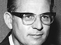
Obituary 2002
|
The site owner makes no assertions as to ownership of any original copyrights to digitized images. However, these images are intended for Personal or Research use only. Any other kind of use, including but not limited to commercial or scholarly publication in any medium or format, public exhibition, or use online or in a web site, may be subject to additional restrictions including but not limited to the copyrights held by parties other than the site owner. USERS ARE SOLELY RESPONSIBLE for determining the existence of such rights and for obtaining any permissions and/or paying associated fees necessary for the proposed use.
