Geology of San Francisquito and Bouquet Canyons.
By Frank Andrew Nickell.
|
Webmaster's note.
Although the significant Bouquet Canyon Fault and lesser faults in the vicinity had been described by that time, much has been written about a "previously unknown" historic earthquake fault at the St. Francis Dam site in San Francisquito Canyon. A 1928 study suggests to the modern reader that the fault may have been known but made no difference. The author found "no topographical evidence of recent activity" and concludes that "the San Francisquito fault is probably a dead one." The study by Frank A. Nickell at CalTech was probably initiated prior to the collapse on March 12 (the author describes the local population as the "workmen at the municipal power houses," plural; there was no second powerhouse for a time after the collapse), but it was completed afterward, as evidenced on page 19 (.pdf page 25). See excerpt below.
Faults (pg. 19 ff.). The San Francisquito fault was displayed in an unusual manner when the St. Francis Dam broke. A detailed section across the fault zone was displayed. The basement complex to the south of the fault has been badly shattered for a distance of 30 feet from the fault. The fault plain itself contains from one-half to four feet of gouge. The Sespe formation to the north has been shattered and the included boulders sheared for an indeterminate distance from the fault plane. The dip of the San Francisquito fault is 39°W, strike N61°E. It is a normal fault with the basement complex to the south rising. In order to have the Tertiary strata dipping steeply toward the south, the net vertical displacement must have been approximately 3900± feet. The horizontal extension that would occur along the normal fault of this throw is probably taken up in this area by over-thrusting along the Clearwater fault. The absence of Tertiary formations later than the Sespe (Oligocene?) formation and the narrowness of the canyon prevents the determination of the period of the latest movement. No topographical evidence of recent activity is to be found and the San Francisquito fault is probably a dead one. The occurrence of steeply dipping Tertiary sediments with strong normal faulting and over-thrusting existing between them and areas of old metamorphic or crystalline rocks has been reported as a common characteristic in the vicinity of the San Andreas Rift. The trend of these areas conform approximately to that of the Rift. The Clearwater Fault [Power House 1 area]. The contact between the Martinez(?) formation and the intrusive mass to the north is an overthrust fault. This fault has a strike N80W, dip 66°S. It is evidenced on the surface by a white zone of brecciated material about a hundred feet wide. The Martinez(?) formation on the south sometimes dips into the fault plane. The amount of overthrusting of the Martinez(?) on the intrusive has resulted in a vertical rise of about 2100± feet. The overthrusting along this fault has taken up the horizontal extension which would otherwise have resulted from the normal faulting along the San Francisquito fault. No age determination of the period of latest movement could be made.
From J. David Rogers (2020)
The old San Francisquito fault did not play a significant role in the failure of the St. Francis Dam, but it did bring a great deal of attention to similar geologic structures in subsequent dams built across faults, which received considerably more study and mitigation (e.g. Morris Dam above Azusa, Rodriguez Dam in Tijuana, and Coyote Dam near Morgan Hill).
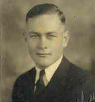
Frank Andrew Nickell, PhD, PE, CEG (1906-75) was born in Beatrice, Nebraska, in March 1906 and grew up in Los Angeles. He earned all of his degrees in geology and civil engineering at Caltech, where he played football. He completed his BS in geology in 1927, M.S. in 1928, and Ph.D. in geology and civil engineering in 1931. During graduate school he was a teaching assistant in languages and physical education (along with his roommate Layton Stanton). His Ph.D. dissertation was on the Geology of the Soledad Quadrangle, Central California. He was the first geologist hired by the U.S. Bureau of Reclamation (in the fall of 1931) to map the rock exposures at Hoover Dam, which began construction in mid-1931. Nickell had already been assisting Caltech Prof. Leslie Ransome with his mapping at Hoover Dam. After Hoover Dam was completed in 1935, he worked on other BurRec dams, including Parker and Grand Coulee. He was named Chief Geologist of the Bureau of Reclamation in 1939, but left to open his own consultancy, based out of Whittier, in 1942. Nickell then took a position with Shell Oil Company and Standard Oil and Gas as a petroleum geologist from 1943 to 1944, but this work took him overseas. From 1945 until 1973 he was a consulting geologist on dams, hydroelectric development, irrigation, and geologic studies for companies and governments worldwide. In the early 1950s he moved to San Mateo, where he remained until he retired and moved to La Jolla, where he died in September 1975. He consulted on dam projects all over the world the remainder of his life, including the ill-fated Taum Sauk Upper Reservoir pumped storage project for Union Electric Co. of St. Louis in the St. Francois Mountains of Missouri. Completed between 1960-64, the rockfill embankment failed by overtopping in December 2005.
|