|
|

Deposition and Deformation in the Northern Soledad Basin.
Doctoral Thesis (Philosophy), California Institute of Technology, Pasadena, 1954.
|
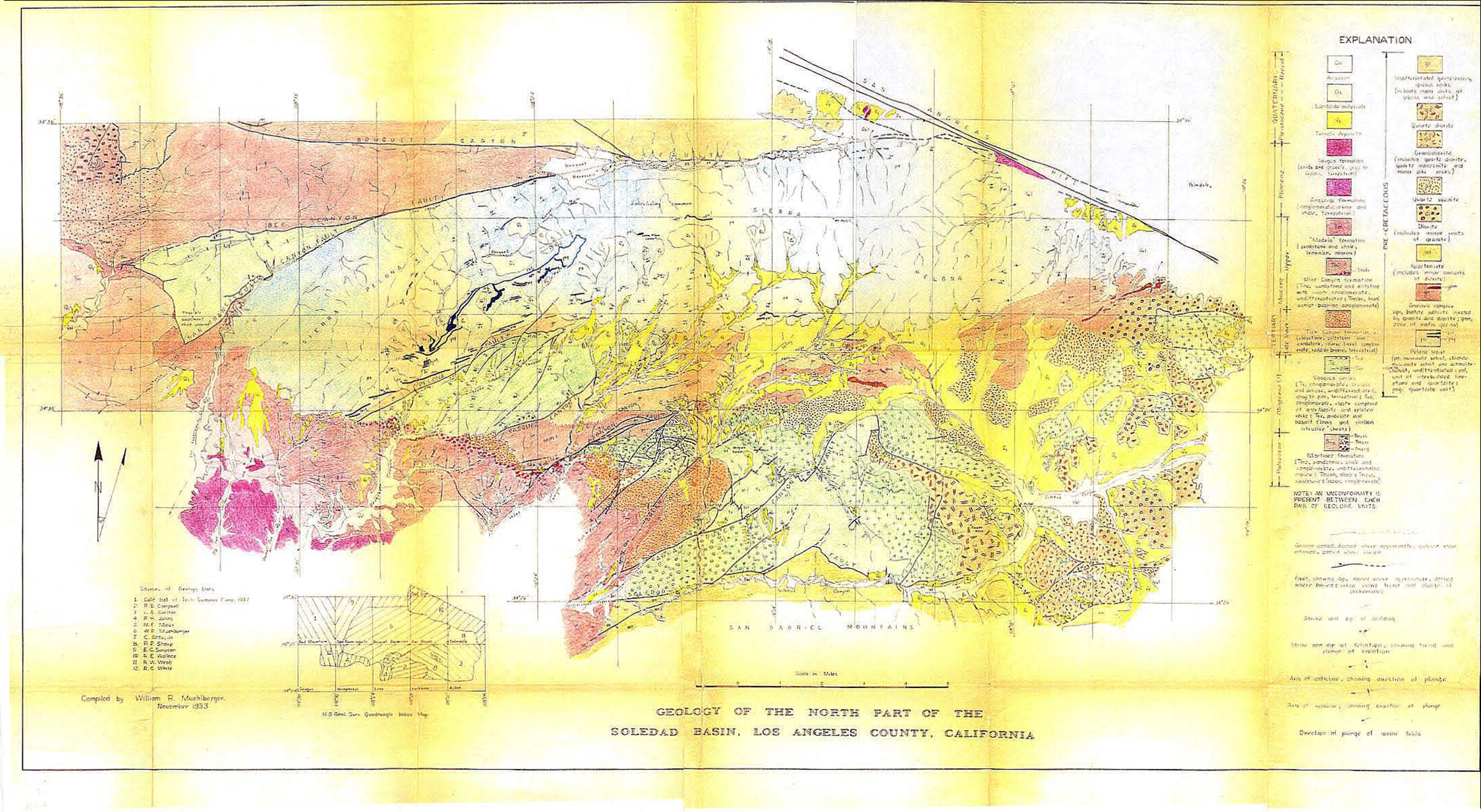
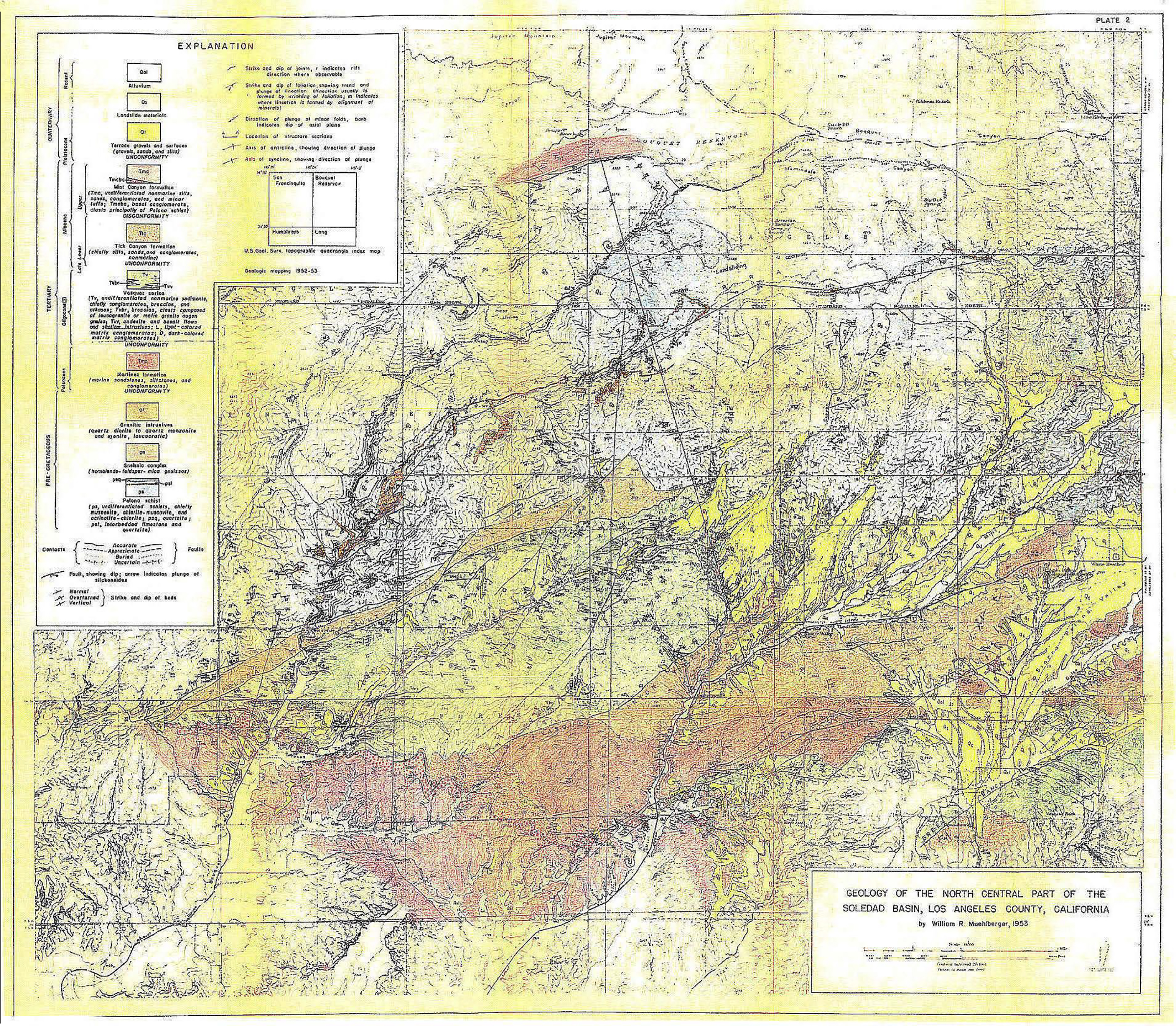
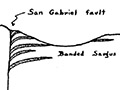
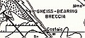
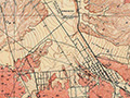
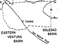
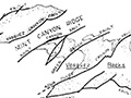
The maps below are part of Muehlberger's paper.
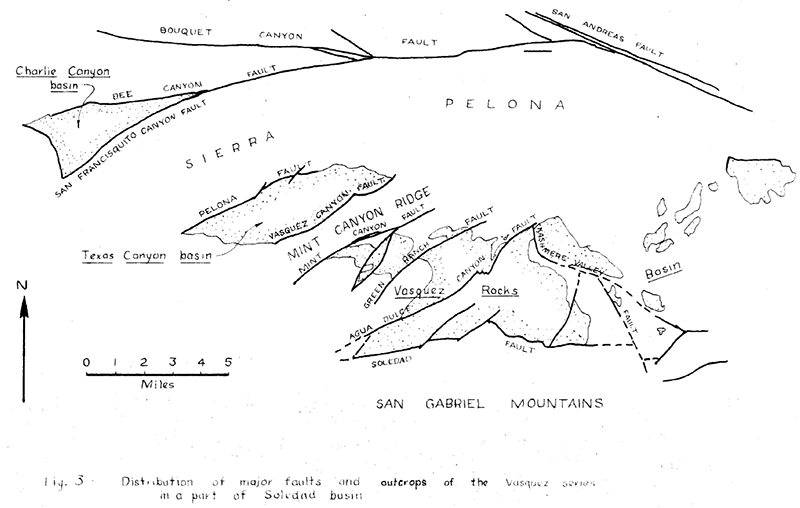
Abstract. The Soledad basin is situated north of the San Gabriel Mountains, in Los Angeles County, California, and its center is about 35 miles north of the Los Angeles civic center. Roughly an elongate parallelogram in shape, this basin has dimensions of about ten by thirty miles, with the longer dimension oriented east-west. The Sierra Pelona and the San Gabriel Mountains form the northern and southern boundaries, respectively. The San Andreas fault and the San Gabriel fault, both of which trend northwest in this region, bound the basin on its northeast and southwest borders, respectively. Only the northern part of the basin is discussed in this paper. The pre-Cretaceous Pelona schist, the oldest unit in the map area, is a thick sequence of muscovite schist, chlorite-muscovite schist and actinolite-chlorite schist with rare layers of quartzite and limestone. This unit underlies the Sierra Pelona, an elongate mountain mass which trends east-west. Granitic intrusive rocks of probable late Jurassic age underlie a complex section of Tertiary rocks in mo st of the eastern Soledad basin. Gneisses, some of which may represent highly injected Pelona schist, also are present in a belt that in general trends parallel to the Sierra Pelona. In general, the sedimentary beds exposed at the surface are younger from east to west in the Soledad basin. The marine Martinez formation of Paleocene age is the oldest sedimentary unit in the region. It is overlain by the Vasquez series which crops out over a wide area, and comprises interlayered fanglomerates and volcanic rocks. Where the Martinez formation has been removed by erosion prior to the deposition of the Vasquez beds, the Vasquez series rests on the preTertiary crystalline rocks. This unit is of doubtful Oligocene age, and has a maximum known thickness of nearly 16,000 feet: The Vasquez beds were deposited in three basins separated by ridges. Late in Vasquez time, these ridges were buried by thick alluvial fans built northward from the San Gabriel Mountains, and the basins thus coalesced into a single broad alluvial apron. The upper Lower Miocene Tick Canyon formation and the Upper Miocene Mint Canyon formation, which lie above the Vasquez series, also represent nonmarine deposition of dominantly coarsegrained sedimentary material. These units are widespread in the western part of the Soledad basin. Sandstone and siltstone of the "Modelo" formation rest unconformably on the Mint Canyon beds, and reflect an eastward encroachment of marine waters over a part of the basin in late Miocene time. West of the map area, the marine Pliocene Pico formation and the nonmarine Plio-Pleistocene Saugus formation, which grades westward into a marine facies, overlie the older rocks. Terrace deposits of late Pleistocene age are common over much of the area. Recent alluvium is present in all of the major valley bottoms and locally in some of the minor valleys. The date of the folding and metamorphism of the Pelona schist is not known, but it assuredly is pre-Tertiary. Tertiary rocks have been either tilted or deformed into broad open folds, although locally near the major faults nearly isoclinal folds are found. Almost without exception, these folds plunge to the west or southwest. The numerous faults are the most prominent structural features of the Soledad basin. Normal faults which trend generally east were formed in post-Martinez, pre-Vasquez time. Displacements occurred throughout Vasquez time and ceased prior to Tick Canyon time. The Pelona fault may have been reactivated just prior to Mint Canyon time. Offsets on these normal faults are as much as 10,000 to 15,000 feet. The normal faults indicate that the minimum compressive stress was oriented nearly north-south. On the other hand, the post- Mint Canyon, pre-Saugus faults indicate a maximum compressive stress oriented north-south, which resulted in a number of northeasttrending left-hand faults with displacements up to 10,000 feet. None of the faults of the Soledad basin have been reactivated in spite of Pleistocene and Recent offsets along the San Andreas fault.
Download pdf here.
|
Video: Field Guide to the San Andreas Fault
1857 Fort Tejon Quake
Fault in Palmdale
Geology of Canyon Country (Dort 1948)
Strike-Slip Displacement (Crowell 1954)
Winterer & Durham 1962
Castaic Geology (Stitt 1981)
Soledad Basin (Muehlberger 1954)
|


The site owner makes no assertions as to ownership of any original copyrights to digitized images. However, these images are intended for Personal or Research use only. Any other kind of use, including but not limited to commercial or scholarly publication in any medium or format, public exhibition, or use online or in a web site, may be subject to additional restrictions including but not limited to the copyrights held by parties other than the site owner. USERS ARE SOLELY RESPONSIBLE for determining the existence of such rights and for obtaining any permissions and/or paying associated fees necessary for the proposed use.
