
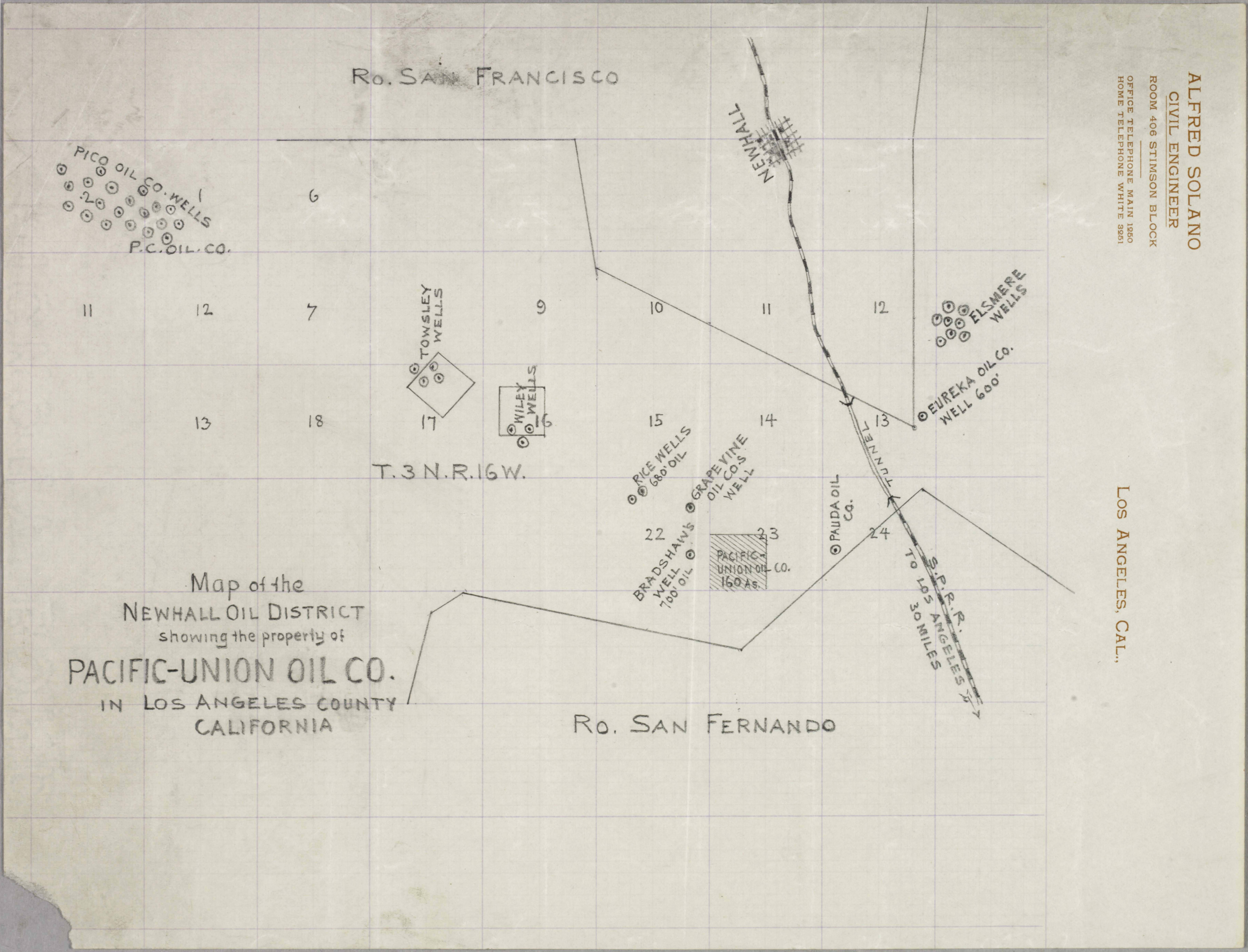
Newhall Oil District Map
Pacific-Union Oil Company

Click image to enlarge
| Download archival scan
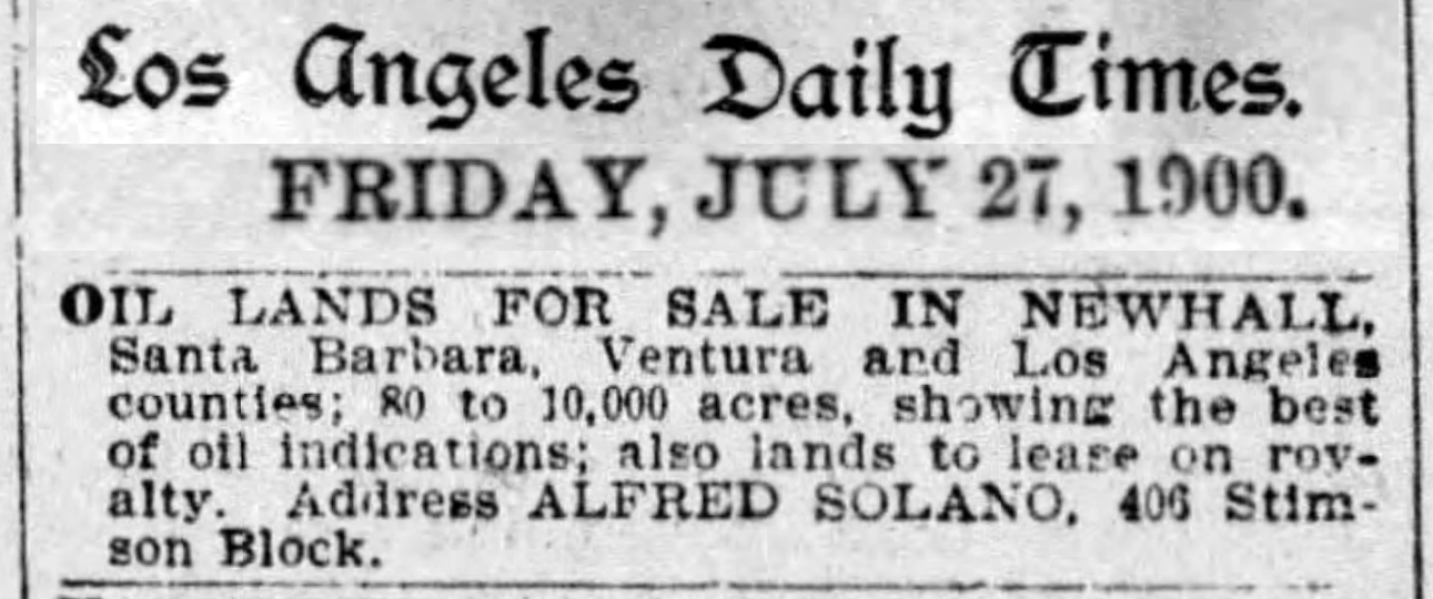
Undated map by Alfred Solano, civil engineer, shows oil well locations in the Newhall region, from Pico Canyon on the west to Elsmere Canyon on the east. The jagged line on the top is the southern boundary of the Rancho San Francisco. For reference, its lower right-hand corner is approximately Beale's Cut. The jagged line on the bottom is the northern boundary of the Rancho San Fernando. The oil operations occur on public lands where mining leases have been filed. (Mining includes petroleum.) The Huntington Library, which holds the original map, estimates the date as "before 1892,"[1] but it's actually about a decade later. Some of the oil wells shown on the map didn't exist in 1892. The Bradshaw well was spudded (drilled) in 1899, Rice Nos. 1 and 2 in 1899-1900, Padua in 1900, and Grapevine in 1901.[2] Little is known about the "Pacific-Union Oil Co." for which the map was evidently commissioned. It was probably one of many unsuccessful speculative oil ventures in the area. Neighboring wells (Grapevine, Padua) survived the test of time, but we are unaware of wells on the 160-acre Pacific-Union parcel, which looks to be a homestead parcel. A similarly named company, the short-lived "Pacific-Union Oil Mining Company" of Los Angeles, was incorporated in 1893.[3] Another company that went by the name "Pacific Union Oil Company" ran afoul of the tax collector in 1895 when it failed to pay its $1.50 quarterly license fee to the City of Los Angeles.[4] It soon disappeared from the scene. The likelier candidate for our map is the "Pacific Union Oil Company" that incorporated in 1900, with operations in Los Angeles County.[5] Its directors were R.A. Fowler, W.H. Morris, W.C. Woodman, W.A. Colwell, T.C. Peck, and J.E. Mapes, and by December 1900, it had reportedly started drilling its first well "four miles north of San Pedro,"[5] which corresponds with other accounts that place its activities in the Whittier area. Other date evidence is the map maker's address. Solano (1857-1943) was a civil engineer with a private practice in downtown Los Angeles and served at various times as the L.A. city and county surveyor.[6] His name appears frequently in L.A. newspapers, but we don't find him at 406 Stimson Block (on South Figueroa Street) before 1900. What we do find is evidence that Solano may have been doing more for the Pacific-Union Oil Company than simply plotting oil well locations. In July 1900, he placed an advertisement in the Los Angeles Times, offering up to 10,000 acres of "oil lands" for sale or lease in "Newhall, Santa Barbara, Ventura and Los Angeles counties" (see below). From this 1921 map, it appears Henry Clay Needham's General Petroleum Co. later owned Pacific-Union property.
1. SR_Map_0775, Solano-Reeve collection, The Huntington Library, San Marino, Calif. Accessed 3/2/2023. 2. Research by local oil historian Stan Walker. 3. Alameda Daily Evening Encinal, May 9, 1893. 4. Los Angeles Times, December 21, 1895. 5. Los Angeles Evening Post-Record, December 28, 1900. 6. Biography at SolanoCanyon.org.
LW3900: SR_Map_0775, Solano-Reeve collection, The Huntington Library, San Marino, Calif.
|
