|
|
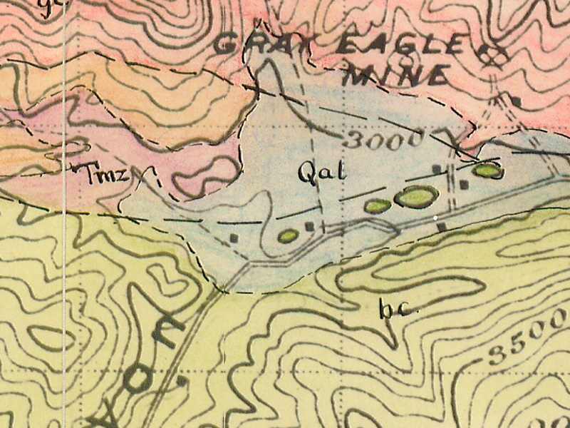
Geology of the St. Francis Dam Area.
Master's Thesis (Geology), California Institute of Technology, Pasadena, 1953.
|
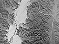
The map below is a part of Elizondo's thesis paper.
Abstract. About 500 feet of Tertiary sediments is exposed in the general vicinity of the old St. Frances Dam Reservoir, in San Francisquito Canyon, Los Angeles County, California. The area where these sediments occur is located in the easternmost part of the Ventura Basin. At least 500 feet of well bedded red siltstones, shales, sandstones and conglomerates of continental origin is overlain by 2700 feet of piedmont deposits made up of coarse conglomerates, fanglomerates, and associated finer grained clastic rocks. No specific age can be assigned to these deposits, but to the north they are unconformably underlain by marine strata of Eocene age. These are thick bedded to massive arkoses. To the west, south and southwest the piedmont deposits are unconformably overlain by non-marine conglomerates and massive sandstones of the Upper Miocene Mint Canyon formation. The evidence prevails that the sediments in the area studied become progressively younger to the south and to the west, as happens everywhere else in the easternmost part of the Ventura Basin. Fossiliferous beds of the uppermost Miocene Modelo formation unconformably overlie the Mint Canyon beds to the south and to the west. Pre-Cretaceous rocks composed of gray, quartz-muscovite, schist crop out in the northeasternmost part of the area. Metaquartzites and quartz veins are minor parts of this terrane. This group of rocks is known as Pelona Schists. Pre- and post-Mint Canyon dip slip reverse faulting seems to form the dominant structural feature of the area. A possibility of normal faulting exists in the northwestern part of the area, between Eocene(?)-Miocene(?) rocks and the Mint Canyon formation, and is fully considered in the text. The sedimentary formations are folded, and the axes follow a northwest-southeast direction in the northern part of the area, and are probalby related to a first stage deformation in pre-Mint Canyon times; to the south, the fold axes trend north-south, and seem to be related to a second stage of deformation that probably took place in post-late Miocene time. The area is in its late youth to early mature state of topographic development. The stream along San Francisquito Canyon cuts across the structure of the Pelona schists indiscriminately for at least one mile, reflecting inheritance of a drainage system established under different conditions. Cavernous weathering is largely confined to many beds of hard, massive, conglomeratic sandstone of Eocene(?)-Miocene(?) age, in the north central part of the area.
Download pdf here.
|
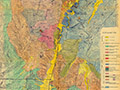
Geology (Nickell 1928)
Geology (Elizondo 1953)
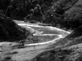
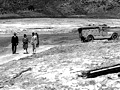
Still Flowing 3/13/1928
San Francisquito Cyn.
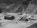
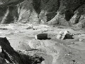
Just Below Dam
San Francisquito Cyn.
Photo Gallery
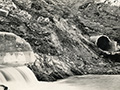
Ruiz Cemetery Area
Lower S.F. Canyon
Castaic Junction x3
3 mi. West of Castaic Junction
|


The site owner makes no assertions as to ownership of any original copyrights to digitized images. However, these images are intended for Personal or Research use only. Any other kind of use, including but not limited to commercial or scholarly publication in any medium or format, public exhibition, or use online or in a web site, may be subject to additional restrictions including but not limited to the copyrights held by parties other than the site owner. USERS ARE SOLELY RESPONSIBLE for determining the existence of such rights and for obtaining any permissions and/or paying associated fees necessary for the proposed use.
